


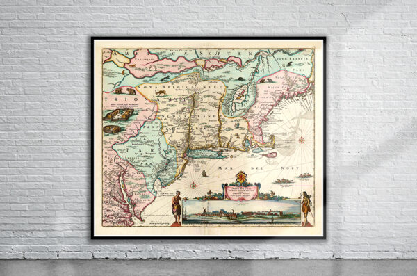
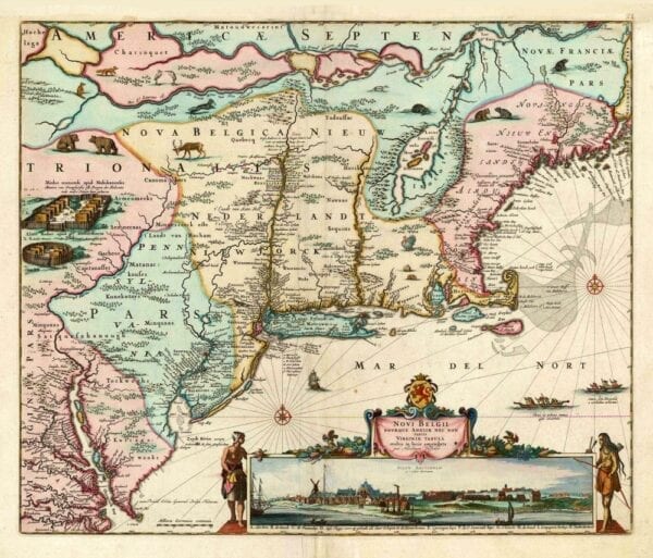
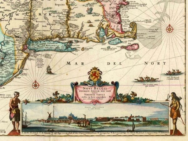
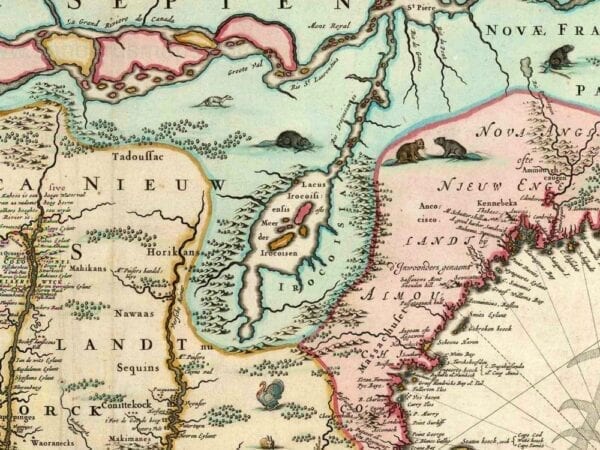

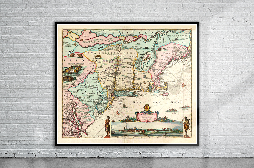
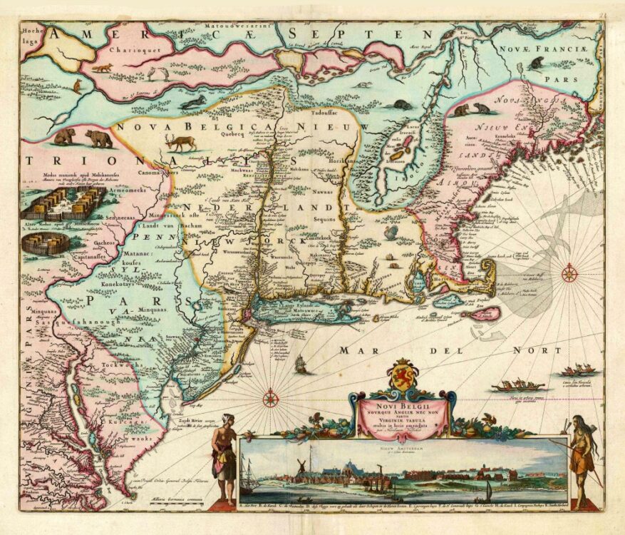
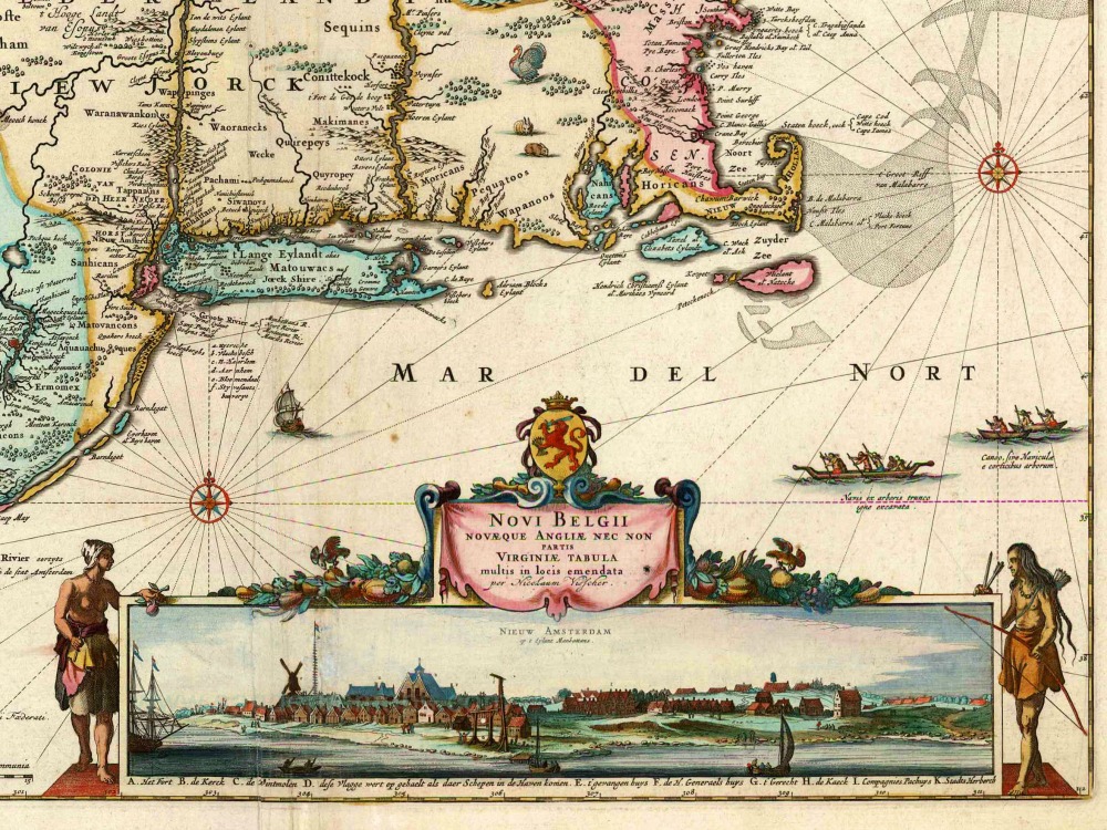
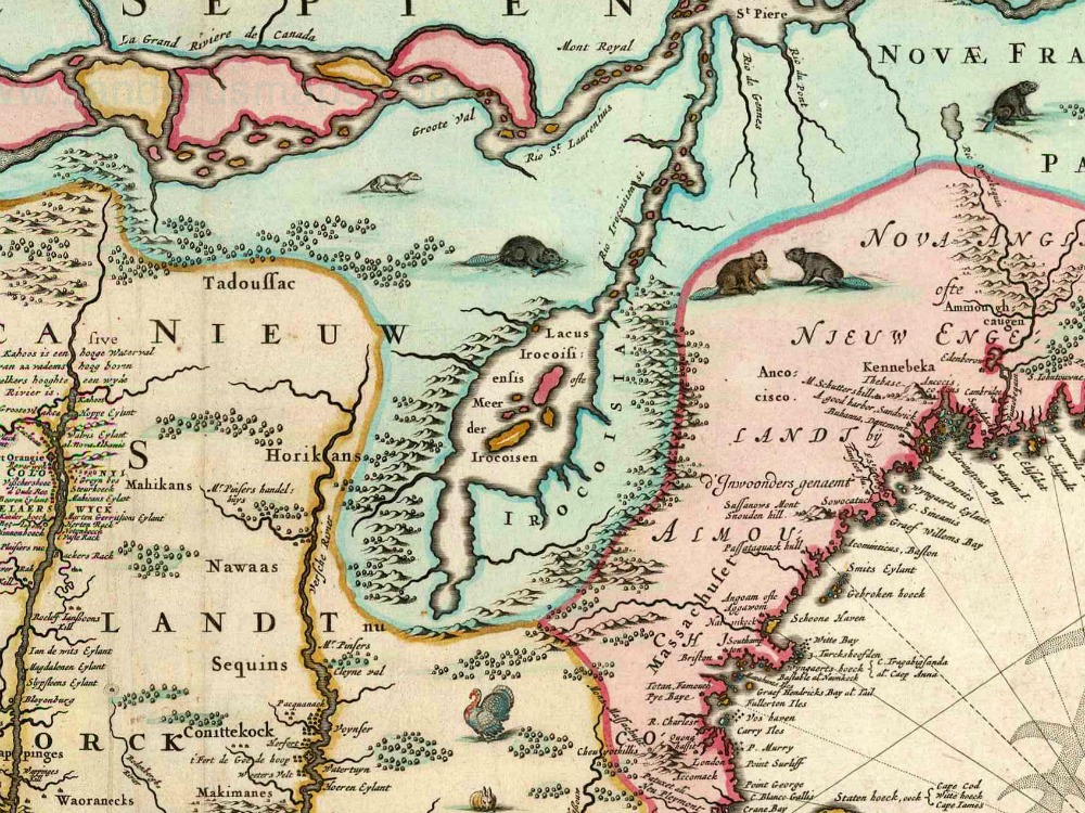
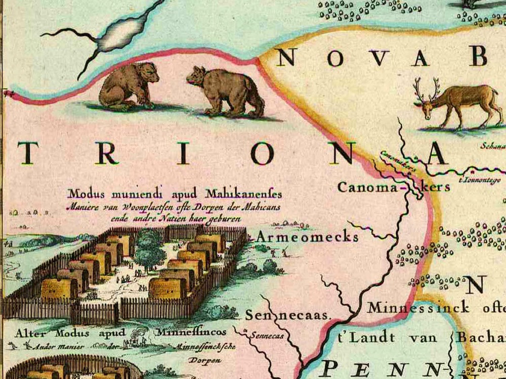
Justus Danckert’s map of New England and the surrounding areas from 1673, including an inset view of the Dutch colony on Manhattan Island. A magnificent full colour and very detailed map.
- Stunning Full Colour Reproduction using the Most Advanced Technology Available
- Printed on Museum Matte Archival Paper 310gm
- Unique Conversation Piece for your Home or Business
- Frame not included