
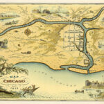
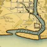


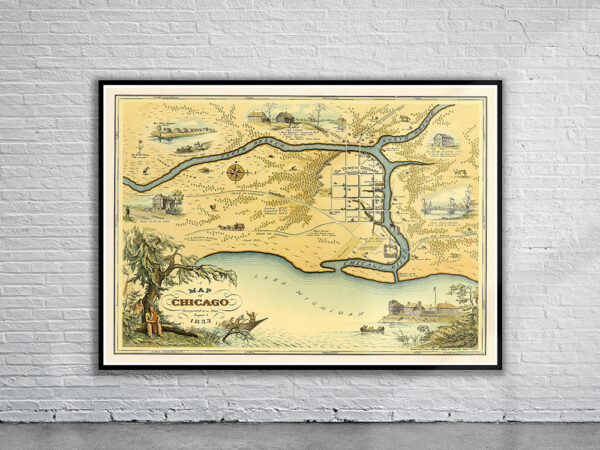
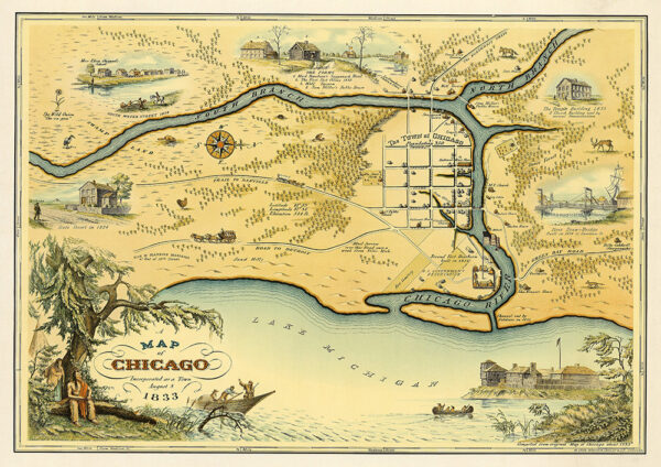
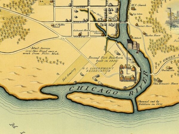
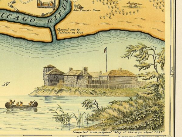

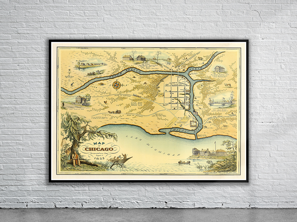
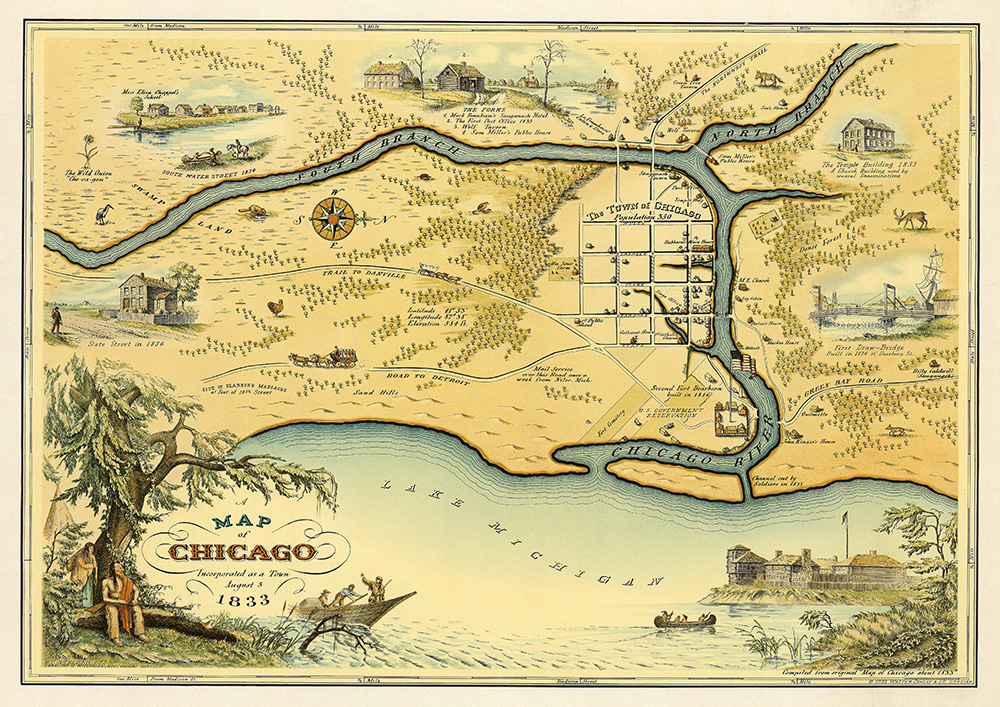
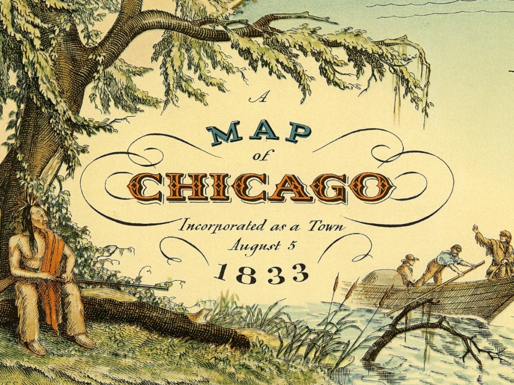
A historical pictorial map showing the city of Chicago, Illinois, at the time of its incorporation in 1833 by Conley & Stelzer. The map was issued upon the Chicago centennial in 1933. It shows Chicago as a small settlement of only four square blocks near where the Chicago River empties into Lake Michigan.
- Stunning Full Colour Reproduction using the Most Advanced Technology Available
- Printed on Museum Matte Archival Paper 310gm
- Unique Conversation Piece for your Home or Business
- Frame not included
