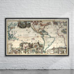
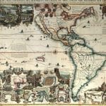
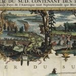
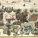
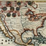
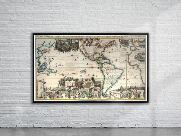
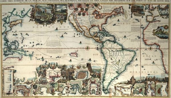

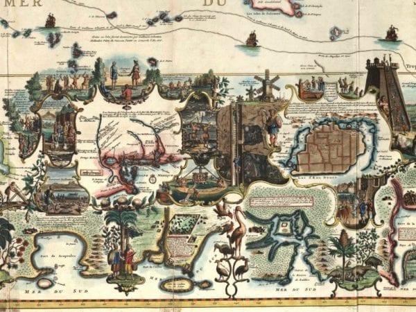
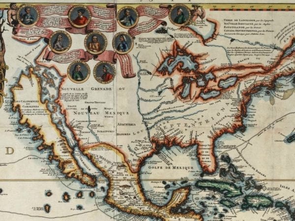
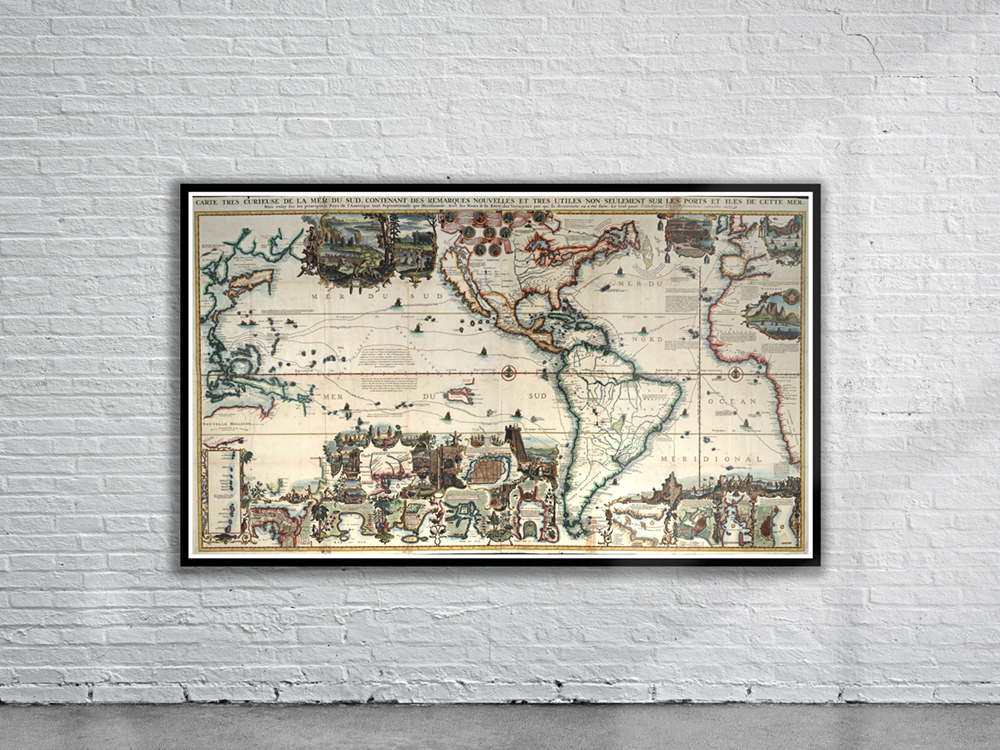
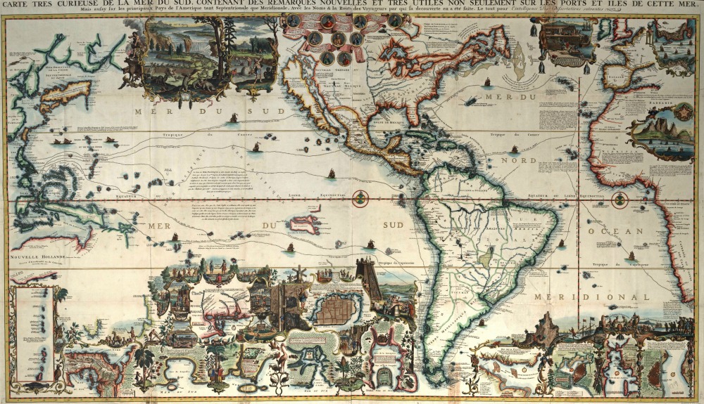
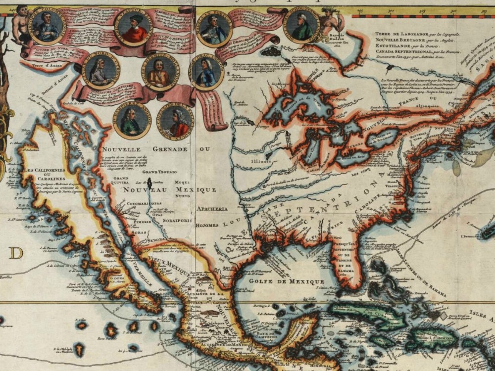
Chatelain’s fascinating map of the world from 1719. he map contains a plethora of geographic information. It tracks the routes of a number of great voyages, including the first encounter with the New World by Columbus in 1492. Also included are two vignettes of beavers, one showing them constructing a dam and the other showing them being hunted by indigenous people. California is shown as an island.
- Stunning Full Colour Reproduction using the Most Advanced Technology Available
- Printed on Museum Matte Archival Paper 310gm
- Unique Conversation Piece for your Home or Business
- Frame not included