


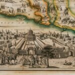

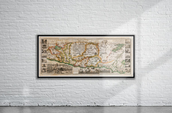

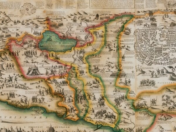
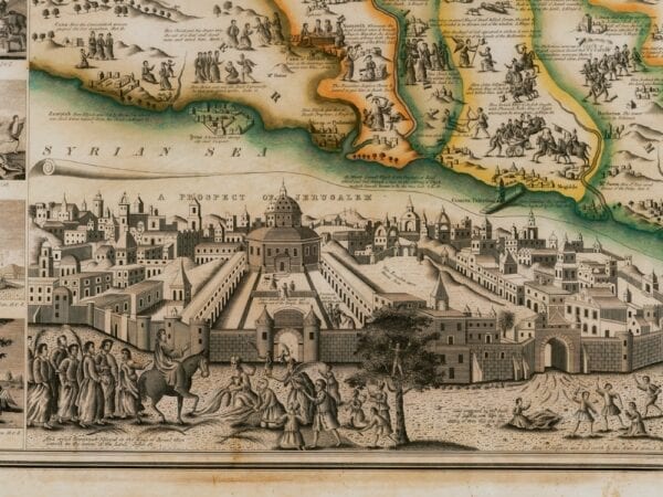

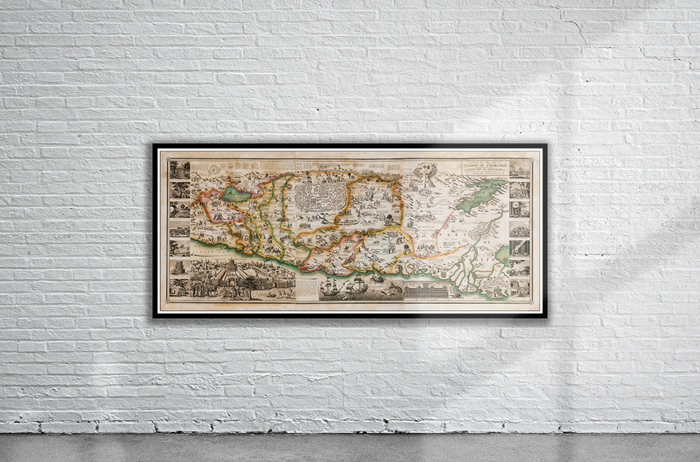
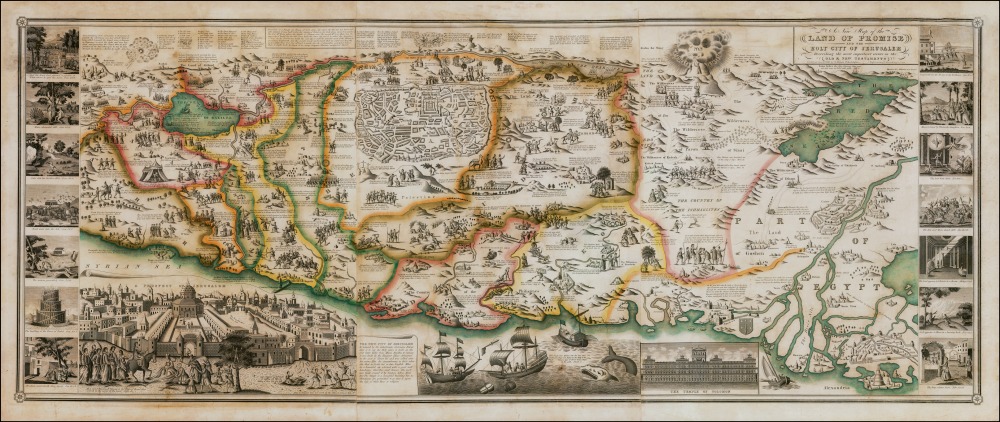
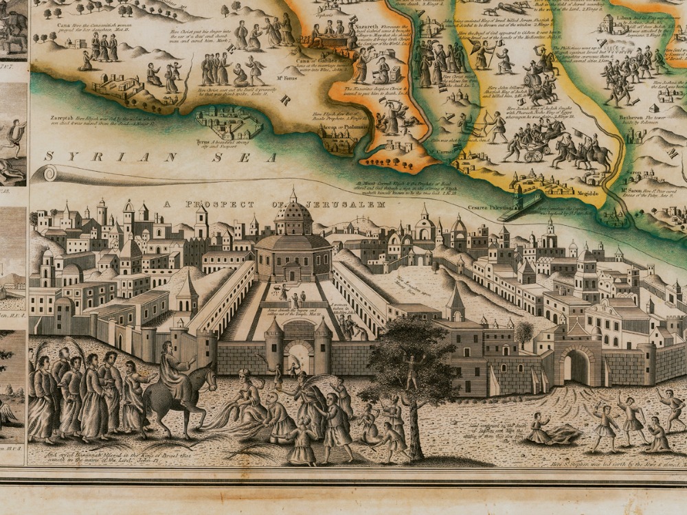
Haines’ Map of the Holy City of Jerusalem from 1828. The map depicts Old and New Testament stories, with pictorial vignettes together with references from the Bible. There is an inset view of the Temple of Solomon, a large inset plan of Jerusalem and an even larger bird’s-eye view of the city, as well as 14 larger vignettes depicting key moments of the Old Testament.
- Stunning Full Colour Reproduction using the Most Advanced Technology Available
- Printed on Museum Matte Archival Paper 310gm
- Unique Conversation Piece for your Home or Business
- Frame not included