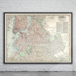
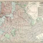
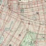
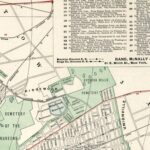
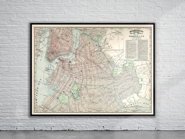
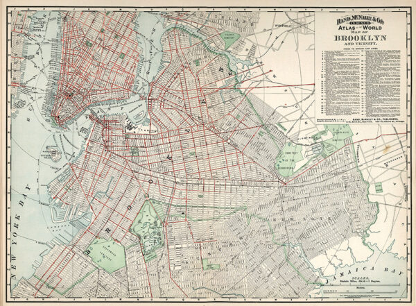
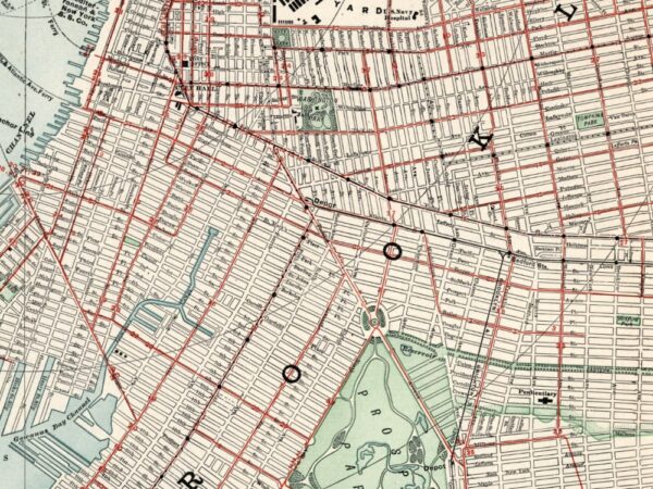
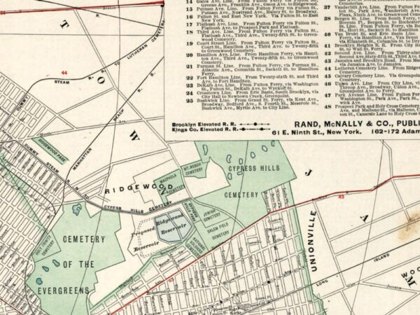
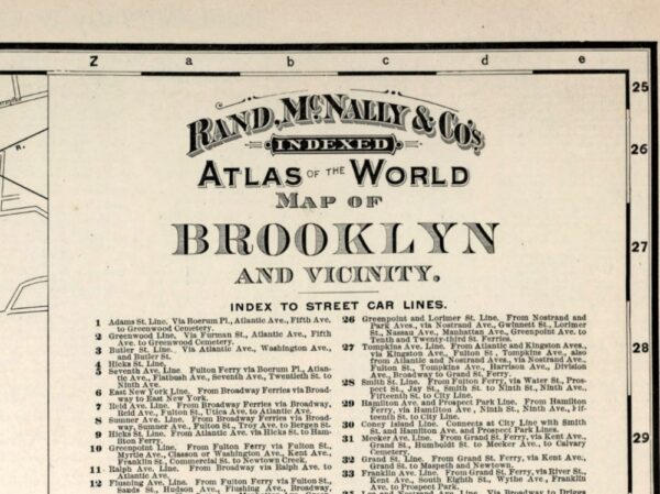
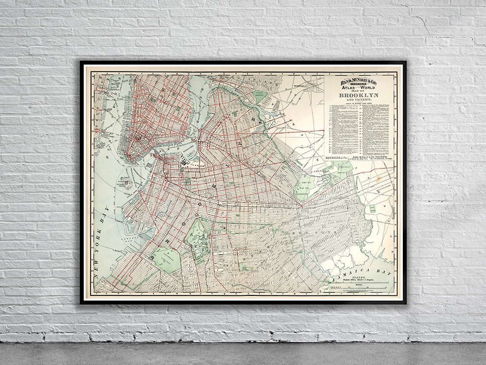
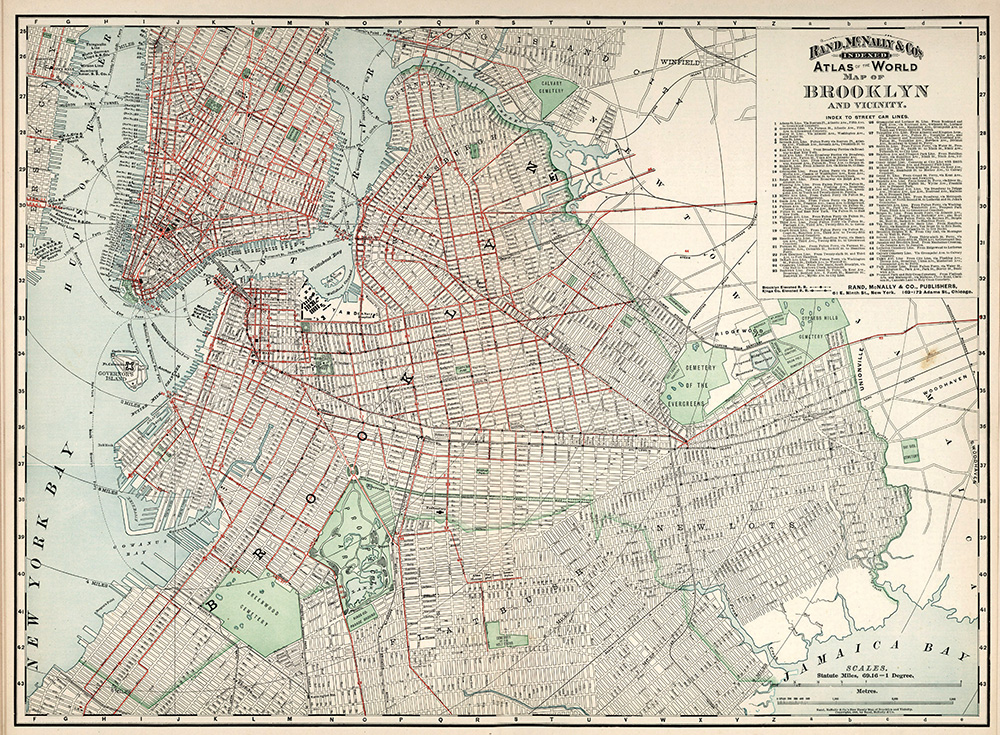
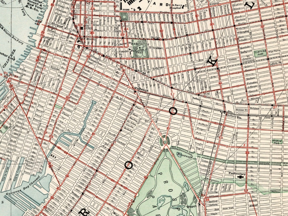
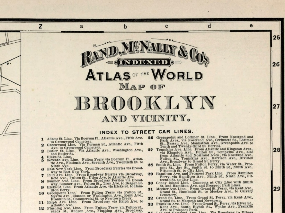
An 1897 Map of Brooklyn, New York by Rand McNally. The map shows major buildings, parks, cemeteries, ferries, tunnels and radial distances from Manhattan.
- Stunning Full Colour Reproduction using the Most Advanced Technology Available
- Printed on Museum Matte Archival Paper 310gm
- Unique Conversation Piece for your Home or Business
- Frame not included